

PARTICIPATORY APPROACHES TO FOREST CARBON PROJECTS
PHASE I: METHODS DEVELOPMENT
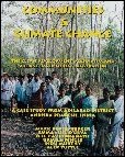
PROJECT PROPOSAL The proposed twelve-month activity would begin January 2002 in order to design and field test methods to prepare Indian forest carbon projects that fulfill the criteria of the Clean Development Mechanism (CDM) as a source of Certified Emission Reductions (CERs). The project would develop and evaluate procedures to establish clear project boundaries and create a baseline for assessing carbon additionality. The methods developed under the proposed CDM&JI supported activity would be presented at the 8th Conference of Parties (COP) in New Delhi in November 2002. The proposed project area targets lands deforested before December 31, 1989 in Adilabad District in the northern portion of Andhra Pradesh, in central India, with biotic conditions that should qualify the land for CDM forest carbon projects (ie. less than 10 percent forest cover). During the first three months of the project, emphasis will be placed on the organizing the methods design team and identifying the boundaries for a future CDM project site. During the next six-month period, the team will conduct vegetative sampling to establish a carbon baseline for the area, estimate carbon additionality, and develop a system for monitoring and verifying changes in carbon stocks during the project implementation period. In the last three-months of the project, the team will produce a report on the findings of the methods trials. The findings will be discussed and reviewed with experts from the Climate Change Bureau of Environment Canada and the Climate Change and Energy Division of DFAIT. The findings will be disseminated through a side event organized during the 8th Conference of Parties to the Climate Change Agreement, and will be distributed in hardcopy and digital formats. PROJECT OBJECTIVES This project seeks to develop operational techniques and procedures for establishing carbon baselines, calculating carbon additionality, and for monitoring and verifying changes in carbon stock over time. The CDM provides an opportunity to finance community-based afforestation and reforestation project in India. Under the CDM, innovative technical, institutional, and financial interventions could be adopted to increase biodiversity and biomass growth and strengthen the capacity of local people's institutions. The modalities and guidelines for operationalizing CDM are being discussed and formalized in the COP/MOP to the Climate Convention Project. The development, implementation, monitoring and verification of the CDM project is unique and complex, particularly as only limited experience is available in the forestry sector (Brown et al, 2000). This project would contribute to the development of methodological protocols to design, monitor, and verify CDM forestry projects by field testing innovative field tools and informing CDM policy makers of the findings. PROJECT SITE DESCRIPTION Indian policy makers, foresters, and scientists are showing increased interest in using the Clean Development Mechanism (CDM) outlined in the Kyoto Protocol to finance community-based afforestation and reforestation projects. A recent feasibility study conducted in Harda Division, Madhya Pradesh, by Community Forestry International (CFI) and its Indian counterparts, has further stimulated the desire of Ministry of Environment and Forestry planners to explore the potential of forest carbon projects. CFI and its Indian partners now seek financing to further develop methods for CDM project development in Adilabad district in the state of Andhra Pradesh. (see map). With some 700,000 hectares of mixed teak forests, Adilabad already is an important area for carbon storage and carbon sequestration. Of the nearly 1,700 villages in the district, 1,008 have formed forest protection committees (FPCs), many of which are engaged in forest protection and reforestation efforts. Within the district there is still 300,000 hectares of land deforested before December 31st, 1989 that would likely qualify for CDM projects. Carbon funds could serve an alternative funding source for the reforestation of this area. Research findings from the Harda forest division in Madhya Pradesh found carbon sequestration rates averaging 2.5 tons per hectare per annum in dry deciduous forests similar to those found in Adilabad district (Poffenberger et al 2001). Adilabad district has 30 forest ranges (see Figure 1, and was selected as a potential CDM project area for five reasons: (1) a large portion of the district is comprised of deforested lands; (2) many of the villages in the district do not have forest protection committees or presently protect the forests; (3) a substantial proportion of the population are members of indigenous tribes who, with some financial incentive, would be prepared to protect and regenerate degrade forests near their communities; (4) most of the population is extremely poor earning an income less than Rs 11,000 (US$ 240) per year per family; and (5) the deforested area in the district is sufficiently large and geographically contiguous to comprise a future CDM project. Before selecting an appropriate site for the project within the district, the design team specified a number of criteria. The first is the need to identify deforested areas with less than 10% canopy closure, but with high potential for carbon sequestration over the life of a project. The second criterion requires that projects demonstrate that carbon credit investments result in additional carbon capture that would not occur in the absence of the project. The third requirement is that the proposed project makes a contribution to the sustainable development of the communities in the area. It would be helpful if the carbon income constitutes at least 25 percent to 30 percent of total family income of the communities selected. The list below shows the key elements that would be part of the first phase of this project. PROJECT ACTIVITIES Project Initiation Workshop During the first three months of the project (January through March), the team will design and implement a methods development workshop. The workshop will involve core members of the project team, as well as a briefing session for representatives from the state forest department and research institutions. The goal of the workshop is to design and discuss the field methods to be used to determine the project area, establish carbon baselines, calculate additionality, and monitor and verify changes in carbon stock. The briefing session will be used to: (1) to inform participants regarding the nature and terms of the CDM (CER) project, and (2) identify a preliminary site for a possible CDM project. Defining Project Boundaries Prior research in the Harda Forest Division of Madhya Pradesh suggests that CDM forest carbon projects in a rural Indian setting might operate effectively if they covered from 5,000 to 15,000 hectares, representing the territory typically found within one central Indian forest range. This scale of operation seems appropriate as social relationships between hamlets provide a basis for building a community-based resource management network at these distances, forest administrative territories fit within this framework, and the territory provides large enough forest areas to generate sufficient carbon-offset revenues to support the costs of project design, monitoring, and verification activities. Methodologies to be used in identifying the boundaries for future forests carbon project sites in Adilabad District would include spatial analysis of vegetative cover and settlement distribution in several forest ranges. These "range profiles," would be based on Survey of India topographic sheets at a scale of 1:50,000, complemented through ground surveys and interviews with local forestry staff and community members. The range profiles would provide information on administrative boundaries, vegetation conditions, existing and potential forest protection groups and user communities in the area, and management conflicts and problems. CDM criteria for deforested lands would be used to identify project sites. Adilabad district was identified as a project site on the basis of biophysical and social-institutional indicators that are consistent with the parameters established for CDM projects. The deforested area can be delineated as a carbon catchment unit with substantial potential for carbon additionality through community protection. For the purpose of this pilot project, the Carbon Catchment Area (CCA) is a precisely defined territory where carbon is stored and sequestered through reforestation occurring through human-induced activities. The CCA boundaries would also consider coherent social and economic units characterized by routine community and market-based interactions. The team will work with forest department field staff, local NGOs, and leaders of forest protection committees to determine initial project boundaries. Project boundaries would be demarcated on maps using physical features, through meetings and ground surveys involving community leaders, community members, and forest department staff. Once the boundaries have been agreed to they will be precisely determined using Global Positioning System (GPS) technologies, and mapped to scale. Establishing a Carbon Baseline This component of the study will measure the level of above and below ground carbon stored in sites selected for the future forest carbon project. Carbon values will be estimated on the basis of equations that convert biomass to carbon at a ratio of 2 to 1. Below surface biomass will also be assessed. The sample framework will be established by laying 50 by 50-meter plots, from which ecological data will be recorded. All the trees above 1.5 meters of height will be enumerated. For each tree, height, species, and tree girth at breast height (GBH), will be recorded. Within these larger plots, smaller quadrats of 5 meters square will be delineated to enumerate seedlings and shrubs fewer than 1.5 meters in height, for which species name and number of individuals would be recorded, and to take soil samples. These data will provide an indication of the status of regenerating seedlings.
Estimating Carbon Additionality
Monitoring and Verification of Carbon Stock Changes (May 2002) The monitoring system will be designed to rely on community-based data collections as well as third party audits suited to a rural Indian context. Community monitoring will be conducted on a continuing basis, with third party audits carried-out every third year. The approach will rely on assessing changes across uniform blocks of landscape with sample measurement sites and remote sensing data used to verify field level findings. Outputs Project outputs would include the production and publication of a report on the CDM tools and techniques developed and field tested during the course of the project. The report would be published in November 2002. The report would describe the purpose of each method, how it is applied in the field, the types of data generated with examples of the findings from field trials. The report would include sample maps of the proposed project area and tables with carbon baseline and additionality data. Guidelines for establishing monitoring and verification systems would also be included in the report. The report would be distributed to the office of CDM&JI by December 2002. The report will also be disseminated to professionals that are involved in the development of operational methods to implement CDM projects, including participants at the VIII Conference of Parties to the Kyoto Protocol to be held in New Delhi, India in November 2002. |
||||||||||||||||||||||||||||||||||

For more information contact [email protected]